The MightyMoRiver Project
Trolling Missouri River info streams.Verified
Kansas City - MODIS Satellite Images - Pre/Post #2011MoRivFlood - via @NASA_EO
22:36 Jul 12 2011 Kansas City, MO


Description
Kansas City, MOExcerpts from NASA Earth Observatory (@NASA_EO) press release:
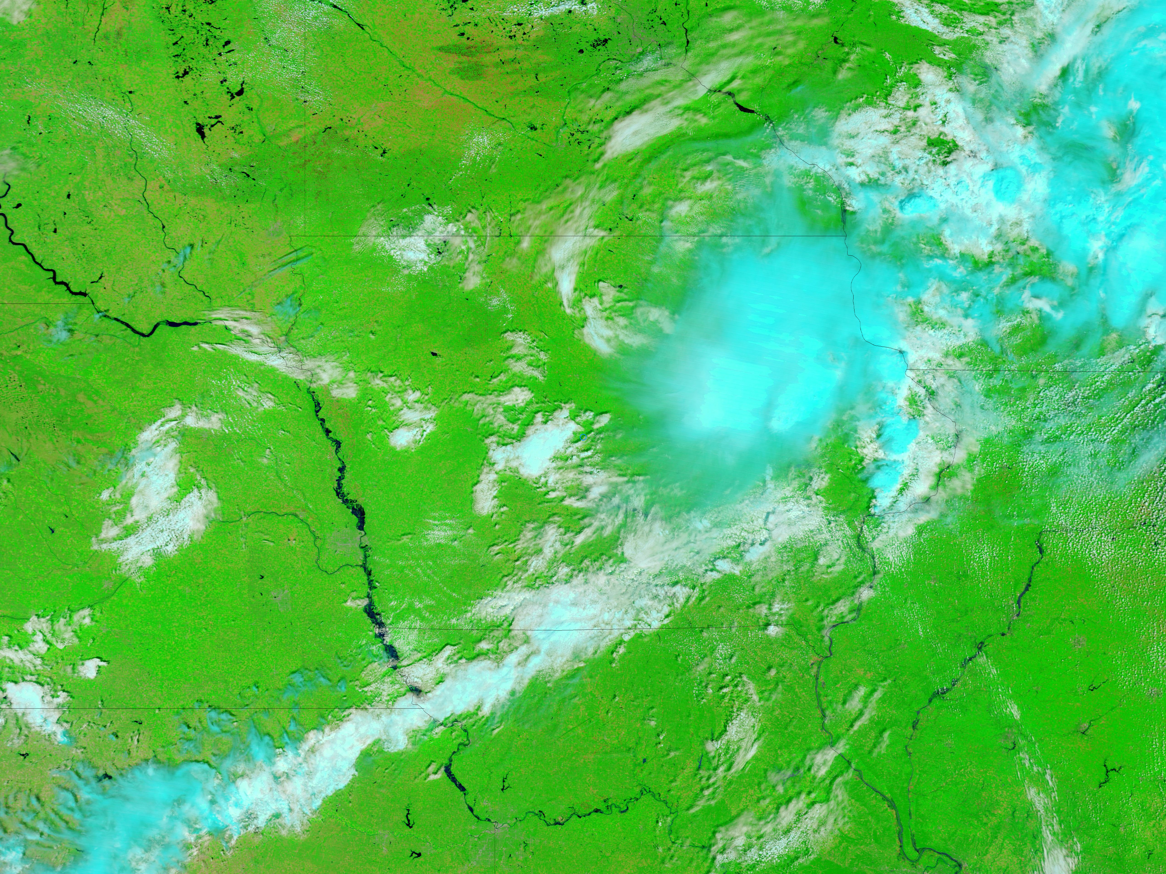
Images taken by Moderate Resolution Imaging Spectroradiometer (MODIS) on Terra satellite Low-resolution versions of each image linked below are posted at picture tab above map.
Full-Resolution Links
Image #1 - July 10, 2011
Image #2 - July 14, 2010
Both images use a combination of visible and infrared light to increase contrast between water and land. Water ranges from electric blue to navy. Land ranges in color from green to brown. Clouds are pale blue-green or off-white and cast shadows.
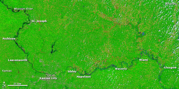
In the image from 2011, flooding is most apparent between Atchison and Leavenworth, but high water is also visible north to St. Joseph, MO and east to Glasgow, MO. Affected communities include Atchison and Leavenworth in Kansas, along with Sibley, Napoleon, Waverly, Miami, and Glasgow in Missouri.
Features
| Credibility: |  |
 |
0 |
Additional Reports
The latest on the Midwest flooding - NBCActionNews.com - Kansas City
14:40 Jun 19, 2011
Kansas City, MO, 39.12 Kms
MoDOT creates web page to guide motorists around flooded highways - Daily Journal
17:43 Jun 21, 2011
Kansas City, MO, 43.8 Kms
A soggy summer awaits along the Missouri River - Atlanta Journal Constitution
13:43 Jun 18, 2011
Kansas City, MO, 44.68 Kms
Missouri - state trooper presumed drowned, search is on for body - #2011MoRivFlood
08:39 Aug 03, 2011
Kansas City, 46.41 Kms
Leave a Comment